自然地理类 知识点题库
Some of the world's most significant problems never hit headlines. One example comes from agriculture. Food riots (暴动)and hunger make news. But the trend lying behind these matters is rarely talked about. This is the decrease in the growth in production of some of the world's major crops. A new study by the University of Minnesota and McGill University in Montreal looks at where, and how far, this decline is occurring.
The authors take a vast number of data points for the four most important crops: rice, wheat, corn and soybeans. They find that on between 24% and 39% of all harvested areas, the improvement in production that took place before the 1980s slowed down in the 1990s and 2000s.
There are two worrying features of the slowdown. One is that it has been particularly sharp in the world's most populous countries, India and China. Their ability to feed themselves has been an important source of relative stability both within the countries and on world food markets. That self-sufficiency (自给自足) cannot be taken for granted if productions continue to slow down.
Second, production growth has been lower in wheat and rice than in corn and soybeans. This is problematic because wheat and rice are more important as foods, accounting for around half of all calories consumed. Corn and soybeans are more important as feed grains. The authors note that “we have preferentially focused our crop improvement efforts on feeding animals and cars rather than on crops that feed people and are the basis of food security in much of the world.”
The report also states the more optimistic findings of another new paper which suggests that the world will not have to dig up a lot more land for farming in order to feed 9 billion people in 2050, as the Food and Agriculture Organization has argued.
Instead, it says, thanks to slowing population growth, land currently ploughed(犁)up for crops might be able to revert (回返) to forest or wilderness. This could happen. The trouble is that the prediction assumes continued improvements in productions, which may not actually happen.
-
(1) What significant problem does the writer think we should pay more attention to?A . The decline of the grain production growth B . News headlines in the leading media. C . Food riots and hunger. D . The food supply in populous countries.
-
(2) Why does the author mention India and China in particular?A . Their big populations are causing worldwide concerns. B . Their food yields have begun to decrease sharply in recent years. C . Their self-sufficiency is vital to the stability of world food markets. D . Their food self-sufficiency has been taken for granted.
-
(3) What does the new study by the two universities say about recent crop improvement efforts?A . They fail to produce the same remarkable results as before the 1980s. B . They contribute a lot to the improvement of human food production. C . They play a major role in guaranteeing the food security of the world. D . They focus more on the increase of animal feed than human food grains.
-
(4) What does the Food and Agriculture Organization say about world food production in the coming decades?A . The growing population will greatly increase the pressure on world food supplies. B . The optimistic prediction about food production should be viewed with caution. C . The slowdown of the growth in yields of major food crops will be reversed. D . The world will be able to feed its population without expanding the area of farmland.
-
(5) How does the author view the argument of the Food and Agriculture Organization?A . It is built on the findings of a new study. B . It is based on a doubtful assumption. C . It is backed by strong evidence. D . It is open to further discussion.
D
My grandson, Daniel, and I have always been very close. When Daniel's father remarried after a divorce, Daniel, who was eleven, and his little sister, Kristie, came to live with us. My husband and I were more than happy to have kids in the house again.
Things were going along just fine until the diabetes (糖尿病) I've lived with most of my adult life started affecting my eyes, and then more seriously, my kidneys (肾). Then everything seemed to fall apart.
Three times a week, I had to go to the hospital to be hooked up to a dialysis machine (透析机). I was living, but I couldn't really call it a life — it was an existence. I had no energy. I dragged myself through daily chores and slept as much as I could. My sense of humor seemed to disappear.
Daniel, seventeen by then, was really affected by the change in me. He tried as hard as he could to make me laugh, to bring back the grandma who loved to clown around (开玩笑) with him. Even in my sorry state, Daniel could still bring a smile to my face.
But things were not improving. After a year on dialysis, my condition was deteriorating (恶化) and the doctors felt that if I didn't receive a kidney transplant within six months, I would surely die. No one told Daniel this, but he knew — he said all he had to do was look after me. To top it off, as my condition worsened, there was a chance that I would become too weak to have the transplant surgery at all, and then there would be nothing they could do for me. So we started the tense and desperate wait for a kidney.
I was adamant (坚决的) that I didn't want a kidney from anyone I knew. I would wait until an appropriate kidney became available, or I would literally die waiting. But Daniel had other plans. The time that he took me to my dialysis appointments, he did a little secret research on his own. Then he announced his intention to me.
“Grandma, I’m giving you one of my kidneys. I'm young and I'm healthy …” He paused. He could see I wasn't at all happy with his offer. He continued, almost in whisper, “And most of all, I couldn't stand it if you weren't around.” His face wore an expression of appeal mixed with determination. He can be as stubborn as a mule (驴) once he decides on something -- but I've been told many times that I can out-stubborn any mule!
We argued. I couldn't let him do it. We both knew that if he gave up his kidney, he would also give up his life's dream; to play football. It was all he ever talked about. And he was good, too. Daniel was co-captain and star defensive tackle (防守阻截队员) of his high school team; he expected to apply for a football scholarship and was looking forward to playing college football. He just loved the sport.
“How can I let you throw away the thing that means the most to you?” I pleaded with him.
“Grandma,” he said softly, “compared to your life, football means nothing to me.”
After that, I couldn't argue anymore. So we agreed to see if he was a good donor (捐赠者) match, and then we’d discuss it further. When the tests came back, they showed Daniel was a perfect match. That was it. I knew I wasn't going to win that argument, so we scheduled the transplant.
Both surgeries went smoothly. As soon as I came out of the anesthesia (麻醉) , I could tell things were different. I felt great! The nurses in the intensive care unit had to keep telling me to lie back and be quiet — I wasn't supposed to be that lively! I was afraid to go to sleep, for fear I would break the spell (魔法) and wake up the way I had been before. But the good feeling didn't go away, and I spent the evening joking and laughing with anyone who would listen. It was so wonderful to feel alive again.
The next day they moved me out of ICU and onto the floor where Daniel was recuperating (复原) three doors away. His grandfather helped him walk down to see me as soon as I was moved into my room. When we saw each other, we did not know what to say. Holding hands, we just sat there and looked at each other for a long time, overwhelmed by the deep feeling of love that connected us.
Finally, he spoke, “Was it worthwhile, grandma?”
I laughed a little ruefully (懊悔). “It was for me! But was it for you?” I asked him.
He nodded and smiled at me. “I've got my grandma back.”
And I have my life back. It still amazes me. Every morning, when I wake up, I thank God -- and Daniel -- for this miracle. A miracle born of the purest love.
-
(1) Grandma's diabetes brought about all the following EXCEPT that _______.
A . her eyes and her kidneys were affected B . grandma became quite a different person C . Daniel had to be sent back to his father D . everything was thrown into confusion -
(2) When grandma was at her lowest, what did Daniel do to bring her back to her usual life?A . He tried his best to make her laugh. B . He helped her with the daily chores. C . He gave up his dream of going to college. D . He searched desperately for a good donor match.
-
(3) How did grandma feel when Daniel announced his intention to give her one of his kidneys?A . She was moved by his selfless decision. B . She wasn't at all happy with his offer. C . She felt relieved that an appropriate kidney was available. D . She was enthusiastic about having a kidney of someone she loved.
-
(4) What would giving up a kidney mean to Daniel, according to the passage?A . He wouldn't be young and healthy thereafter. B . He didn't have to search for a good match any more. C . He could apply for a full scholarship to a college he desired. D . He would also give up his life's dream: to play football.
-
(5) How was grandma when she came out of the anesthesia after the surgery?A . She was feeling low. B . She was full of life. C . She was exhausted. D . She was the way she had been before.
-
(6) Which of the following statements is NOT true according to the passage?A . Grandma got her life back thanks to Daniel's selfless donation. B . Grandma thought her returning to life was a miracle of pure love. C . Daniel agreed with grandma that the transplant was worthwhile for her, not for him. D . Much as he loved football, grandma's life meant the most to Daniel.
The Leaning Tower of Pisa was straight like a pole when the construction began in 1173. It started to shift direction soon after construction because of poor foundation in addition to the loose layer of subsoil(底土). At the beginning, it leaned to the southeast before the shaky foundation started to shift leaning towards the southwest. After the period of structural strengthening at the beginning of the 21st century, now the Leaning Tower of Pisa leans at an angle of 3.97 degrees.
In 1178, the shift in direction was observed for the first time when the construction had progressed further to the third floor. The tower was heavy for the three-meter foundation that was built on a weak area of land.
For compensating(补偿) the leaning position, the builders started to construct the upper floors with one side higher than the other one. This caused the tower to lean in the other direction. This unusual structure led to the tower being actually curved. In spite of these efforts, the tower kept on leaning.
The government of Italy started to plan prevention of the complete collapse of the tower in 1964. However, a request was put forward by the authorities to keep the leaning position because of the tourism industry of the region.
After nearly two decades of careful planning by engineers, historians and mathematicians, the stabilization efforts for the Leaning Tower of Pisa started in 1990. The tower was closed for the general public and the people living nearby moved away. For reducing the total weight of the tower, its seven bells which represented the seven musical notes were removed. The tower was reopened for the general public on December 15, 2001.
In May 2008, after removing another 70 metric tons of earth, the engineers announced that the tower had been finally stabilized and it would remain stable for at least 200 years.
-
(1) The Leaning Tower of Pisa began to lean probably because ________.A . it was too high like a pole B . its foundation shook badly C . the work of repair was delayed D . the soil of its foundation was too weak
-
(2) People noticed the Leaning Tower of Pisa shift its direction ________.A . as soon as it was constructed B . during the construction C . at the end of the construction D . as soon as it was completed
-
(3) Who preferred not to change the leaning position of the Leaning Tower of Pisa?A . The authorities. B . The government. C . The engineers. D . The historians.
-
(4) Which of the following is the right order according to this passage?
a. People noticed the tower began to shift its direction.
b. The repair work was carried out last time.
c. The Leaning Tower of Pisa was repaired for the first time.
d. The Leaning Tower of Pisa was built.
e. The tower was opened to the visitors again.
f. The government started to make a plan for the tower.
A . c, d, a, f, b, e B . f, e, a, d ,c, b C . d, a, f, c, e, b D . d, e, b, f, c, a
Chiang Mai is proud of the city's 700- year history, which has rich traditional relics and unique culture. It is located 700 km north of Bangkok and is situated among the highest mountains in the country. Chiang Mai means “the new city” in Thai. King Mengrai founded the city as the capital of the Lanna Kingdom on April 12,1296. Therefore, Chiang Mai not only became the capital and cultural center of the Lanna Kingdom, but was also to be the center of Buddhism in northern Thailand. King Mengrai , a very religious leader, founded many of the city's temples (寺庙) that remain important today.
It is one of the few places in Thailand where it is possible to experience both historical and modern Thai Culture. The city has old temples next to modern stores. It has more than three hundred temples, among which some are the most beautiful and honorable in the entire Buddhist world, giving the city an atmosphere (氛围) of calmness.
The old city of Chiang Mai has various dialects, architecture, traditional values, festivals, handicraft and classical dances. In addition, it has hill tribes and their wealth of unique culture. Chiang Mai city features old-world beauty and charm as well as modern enjoyment and convenience. It is also filled with natural resources including mountains, waterfalls and rivers. Nowadays there are many activities and attractions both in the city and the surrounding province, including river rafting , elephant riding and golf.
The quality of living is excellent. Accommodation and food are of the highest standard at a very low cost. Entertainment is plentiful with numerous festivals, outdoor activities and great nightlife. A number of elephant camps, numerous outdoor activities, a variety of handicraft workshops, various cultural performances, and breathtaking scenery make Chiang Mai one of Asia's most attractive tourist destinations.
-
(1) What can we learn from the first Paragraph.?A . Chiang Mai is a new city in Thailand. B . Chiang Mai is the cultural center all over the world. C . Many temples in Chiang Mai have several hundred years of history. D . Bangkok lies among the highest mountains in Thailand.
-
(2) Which words best describe the life in Chiang Mai according to the passage?A . Old and hopeless. B . Busy and polluted. C . Poor and inconvenient. D . Calm and attractive.
-
(3) What is the purpose of the text?A . To introduce the city of Chiang Mai. B . To educate the locals of Chiang Mai. C . To instruct the visitors of Chiang Mai. D . To show the author's respect for Chiang Mai.
Would it surprise you to learn that, like animals, trees communicate with each other and pass on their wealth to the next generation?
UBC Professor Simard explains how trees are much more complex than most of us ever imagined .Although Charles Darwin thought that trees are competing for survival of the fittest, Simard shows just how wrong he was. In fact, the opposite is true: trees survive through their co-operation and support, passing around necessary nutrition “depending on who needs it”.
Nitrogen(氮) and carbon are shared through miles of underground fungi(真菌) networks, making sure that all trees in the forest ecological system give and receive just the right amount to keep them all healthy. This hidden system works in a very similar way to the networks of neurons(神经元)in our brains, and when one tree is destroyed, it affects all.
Simard talks about “mother trees”, usually the largest and oldest plants on which all other trees depend .She explains how dying trees pass on the wealth to the next generation, transporting important minerals to young trees so they may continue to grow .When humans cut down “mother trees” with no awareness of these highly complex “tree societies” or the networks on which they feed, we are reducing the chances of survival for the entire forest.
“We didn't take any notice of it .” Simard says sadly. “Dying trees move nutrition into the young trees before dying, but we never give them chance.” If we could put across the message to the forestry industry, we could make a huge difference towards our environmental protection efforts for the future.
-
(1) The underlined sentence “the opposite is true” in Paragragh2 probably means that trees________.A . compete for survival B . depend on each other C . provide support for dying trees D . protect their own wealth
-
(2) “Mother trees” are extremely important because they________.A . look the largest in size in the forest B . know more about the complex “tree societies” C . pass on nutrition to young trees D . seem more likely to be cut down by humans
-
(3) The underlined word “it” in the last paragraph refers to .A . how “tree societies” work B . how trees grow old C . how forestry industry develops D . how young trees survive
-
(4) What would be the best title for the passage?A . Old Trees Communicate Like Humans B . Young Trees Are In Need Of Protection C . Trees Contribute To Our Society D . Trees Are More Awesome Than You Think
Guinness World Records has long been recording some of the most amazing and astonishing travel and tourism facts. Here we are sharing some of the most unbelievable record-breaking accounts, all fully fact-checked and Guinness-approved.
Largest Ice Structure—The Ice Hotel in Sweden
Each year, the ice hotel in Jukkasjarvi, Sweden, is rebuilt from blocks of frozen ice from the nearby River Torne. Covering an area of 5,500 square metres, the hotel is unsurprisingly open seasonally, from December to March, when it melts away. In 2015, the hotel celebrated its 25th anniversary, complete with an ice bar, an ice church and ice bedrooms—one even featured a London Tube carriage made entirely of ice.
Tallest Waterfall—Angel Falls, Venezuela
The largest waterfall by vertical(垂直的) area may be Victoria Falls, which sit on the border between Zimbabwe and Zambia, but it's South America that's home to the world's tallest.
Angel Falls, located in Bolivar, Venezuela, has an impressive, uninterrupted drop of 807 metres.
It was actually named after the American pilot, Jimmie Angel, who first recorded it in his logbook on November 16, 1933.
Largest Area of Glowing Sea—Indian Ocean, near Somalia
Bioluminescence(生物体发光) is the production and emission of light by a living thing and can be used to explain the surprising phenomenon(现象)of “glowing oceans.”
It was in 1995 that scientists detected glowing sea in the Indian Ocean—just off the coast of Somalia-via satellite, The water was more than 250 kilometres long, and it was all thanks to the bacteria called phytoplankton.
Most Expensive Hotel Room—The Royal Penthouse Suite at Geneva's Hotel President Wilsom
This particular suite is just the ticket, costing as much as US$83,000(£53,760)per night.
But the high price will gain you access to 12 bedrooms and 12 marble bathrooms across 18,000 square feet.
-
(1) Where is the tallest waterfall situated?A . Between Zimbabwe and Zambia. B . In South America. C . In northern Europe. D . In South Africa.
-
(2) What can we learn about the largest area of glowing sea?A . It was first recorded in 1933. B . It was named after an American pilot. C . It was first detected by satellite. D . It is the only sea that is glowing.
-
(3) What can you experience if you go to the Royal Penthouse Suite at Geneva's Hotel President Wilson?A . The most beautiful natural scenery. B . The most expensive and luxurious suite. C . The largest and most powerful waterfall. D . The largest rooms.
-
(4) Where might we find this text?A . In a cultural book. B . In a travel magazine C . In a fashion magazine. D . In an instruction book
Deserts are found where there is little rainfall or where rain for a whole year falls in only a few weeks' time. Ten inches of rain may be enough for many plants to survive if the rain is spread throughout the year. If it falls within one or two months and the rest of the year is dry, those plants may die and a desert may form.
Sand begins as tiny pieces of rock that get smaller and smaller as wind and weather wear them down. Sand dunes (沙丘) are formed as winds move the sand across the desert. Bit by bit, the dunes grow over the years, always moving with the winds and changing the shape. Most of them are only a few feet tall, but they can grow to be several hundred feet high.
There is, however, much more to a desert than sand. In the deserts of the southwestern United States, cliffs (悬崖) and deep valleys were formed from thick mud that once lay under a sea more than millions of years ago. Over the centuries, the water dried up. Wind, sand, rain, heat and cold all wore away at the remaining rocks. The faces of the desert mountains are always changing –-very, very slowly —as these forces of nature continue to work on the rock.
Most deserts have a surprising variety of life. There are plants, animals and insects that have adapted to life in the desert. During the heat of the day a visitor may see very few signs of living things, but as the air begins to cool in the evening, the desert comes to life. As the sun begins to rise again in the sky, the desert once again becomes quiet and lonely.
-
(1) Many plants may survive in deserts when___________.A . it is dry all the year round B . the rain falls only in a few weeks C . there is little rain in a year D . the rain is spread out in a year
-
(2) Sand dunes are formed when____________.A . sand piles up little by little B . there is plenty of rain in a year C . the sea has dried up over the years D . pieces of rock get smaller
-
(3) The underlined sentence in the third paragraph probably means that in a desert there is_____.A . too much sand B . more sand than before C . nothing except sand D . something else besides sand
-
(4) It can be learned from the text that in a desert____________.A . there is no rainfall throughout the year B . life exists in rough conditions C . all sand dunes are a few feet high D . rocks are worn away only by wind and heat
Queensland is one of the most amazing states in Australia. It has some of the most beautiful natural scenery on the planet, with the Great Barrier Reef, rainforests and impressive beaches.
The Great Barrier Reef
It is one of the world's largest natural features. It stretches more that 2,300 km along the north eastern coast of Australia from the northern tip of Queensland to just north of Bundaberg. The things that most surprise visitors to the reef are the colors.
Without doubt, the best way to see the Great Barrier Reef is by diving. If you have a little extra money and you are feeling a bit lazy, you can fly over the reef in a plane.
Fraser Island
Another area of natural beauty is Fraser Island. This is the world's largest sand island. It's best visited from Hervey Bay on the mainland, where there are a number of places offering trips around the island. To fully appreciate Fraser Island you should go for three or four days. Attractions include some beautiful fresh-water lakes, particularly Lake Wabby and Lake Mckenzie. You can walk around these on white sands untouched by human footprints. Indian Head also has some beautiful views. Braver travelers can go and watch sharks circling the water hundreds of meters below.
The Whitsunday Islands
It would be a pity to travel around Queensland without taking a trip around the Whitsunday Islands. They were named by Captain Cook in 1770, after the day on which he arrived. Here are some of the great things you can do there.
●Cruise around them on a relaxing trip.
●Take a sailing course.
●Look at the aboriginal (土著的) paintings in caves on Hook Island.
●Have fun in the water doing lots of water sports.
So, will you be going to Queensland?
-
(1) The best way to admire the beauty of the Great Barrier Reef is .A . diving in the sea B . taking a boat C . flying in a plane D . driving
-
(2) What can we infer from Fraser Island?A . Few places on the mainland can offer trips around the island. B . One should have at least 2 days to fully explore Fraser Island. C . Lake Wabby and Lake Mckenzie are rarely visited places. D . Only brave ones can watch sharks in the deep ocean.
-
(3) If you want to learn sailing, you can go to .A . Hook Island B . The Whitsunday Islands C . Fraser Island D . the Great Barrier Reef
-
(4) The purpose of writing this passage is .A . to adverse for Queensland B . to inform the latest news C . to call on people to protect Queensland D . to break a world record
The National Gallery
Description:
The National Gallery is the British national art museum built on the north side of Trafalgar Square in London. It houses a different collection of more than 2,300 examples of European art ranging from 13th-century religious paintings to more modem ones by Renoir and Van Gogh. The older collections of the gallery are reached through the main entrance while the more modem works in the East Wing are most easily reached from Trafalgar Square by a ground floor entrance
Layout:
The modem Sainsbury Wing on the western side of the building houses 13th- to 15th-century paintings, and artists include Duccio, Uccello, Van Eyck, Lippi, Mantegna, Botticelli and Memling.
The main West Wing houses 16th-century paintings, and artists include Leonardo da Vinci, Cranach, Michelangelo, Raphael, Bruegel, Bronzino, Titan and Veronese.
The North Wing houses 17th-century paintings, and artists include Caravaggio, Rubens, Poussin, Van Dyck, Velazquez, Claude and Vermeer.
The East Wing houses 18th- to early 20th-century paintings, and artists include Canaletto, Goya, Turner, Constable, Renoir and Van Gogh.
Opening Hours:
The Gallery is open every day from 10am to 6pm (Fridays 10am to 9pm) and is free, but charges apply to some special exhibitions.
Getting There:
Nearest underground stations: Charing Cross (2-minute walk), Leicester Square (3-minute walk), Embankment (7-minute walk), and Piccadilly Circus (8-minute walk).
-
(1) In which century's collection can you see religious paintings?A . The 17th. B . The 13th. C . The 18th. D . The 20th.
-
(2) Where are Leonardo da Vinci's works shown?A . In the East Wing. B . In the Sainsbury Wing. C . In the main West Wing. D . In the North Wing.
-
(3) Which underground station is closest to the National Gallery?A . Piccadilly Circus. B . Leicester Square. C . Embankment. D . Charing Cross.
阅读下列短文,从每题所给的四个选项(A、B、C和D)中,选出最佳选项。
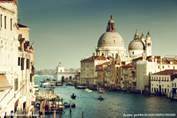
A city without cars would be very strange, right? But Venice is such a city.
Venice is in the northeast of Italy. It wasn't built on land, like Beijing or Shanghai, but on more than 110 islands. Seawater is everywhere around the city.
Even so, travel isn't difficult. The waterways have always been the best way to get around. There are 117 waterways and more than 400 bridges that can guide you where you want to go. People in Venice move from place to place by boat.
Water makes the city special, but it is also a big problem. Sometimes tourists will have such strange experiences. One moment they walk across the Rialto Bridge, and there's nothing special. But when they come back to the bridge an hour later, it's underwater and everyone is wearing rain shoes.
Once, people used too much underground water. This made the city get lower little by little. Now the city has gone down by 23 centimeters. Another problem is the rising seawater. The temperature has risen over the years. This has made the ice of the Arctic Ocean (北冰洋) melt (融化). Every year, high waters hit the city in autumn and winter. When a lot of water comes, more than half of the city is underwater.
Scientists are trying different ways to stop the city from getting even lower. The Italian government has asked some of Italy's biggest companies to build the MOST project, which was planned to be build under the seawater to stop the rising water. Anyway, this project is helping solve the problem.
-
(1) Which is the best way to travel in Venice?A . The waterways. B . Taxis and cars. C . 400 bridges. D . Boats and rain shoes.
-
(2) What doesn't cause Venice to get lower and lower?A . The ice of the Arctic Ocean melt. B . Seawater is everywhere around the city. C . People used too much underground water D . The temperature has become higher over the years.
-
(3) What can we infer from the last passage?A . Venice is sure to stop getting lower. B . High waters won't hit Venice any more. C . Scientists can solve the problems easily. D . Some possible ways help to solve the problem.
-
(4) What's the best title of this passage?A . The History of Venice B . The MOST Project of Venice. C . The Places of Interest of Venice D . The Specials and Problems of Venice
It's not often you get information about a destination from a heavy metal band, but in Debrecen, Hungary's second largest city, locals are used to having to make a noise to get heard.
Just off the historic center, Roncs bar is a pub that also hosts live music. It has the atmosphere of a student party in an old building that might soon be knocked down.
Roncs is owned by Hungary's best-known heavy metal rock band, Tankcsapda. Sometimes referred to as the “Hungarian Metallica", the band has taken a type of music that is famous worldwide and-through lyrics, album covers, and an annual New Year's party and concert-made it all about their home city.
It's perhaps fitting that Tankcsapda should be seen as ambassadors for Debrecen-the city sometimes needs loud heavy metal rock music to get noticed. “Foreigners think that Hungary is Budapest and there's nothing else,” is a familiar saying on Debrecen's:streets.
Debrecen has, at times, been more important than the current seat of power, with locals claiming it takes over in times of trouble.
That doesn't quite add up.
Debrecen survived an attack from the Mongols in the 13th century, the Black Death, 150 years of struggle against the Ottomans and numerous conflicts, and yet it has still only briefly been the country's capital twice. This happened for the first time after a short-lived revolution in 1849, and for a second time at the end of World War II.
Today, Debrecen may not be well known to tourists, but that only adds to the charm of this relaxed city. It's a small place; the historical center is sized for strolling (散步) and regular cafe stops. There's also a view of Debrecen's mix of architectural styles, a result of the frequent large fires that back in the 19th century led the city's students to form one of Europe's first-ever fire brigades (消防队).
You can also see traditional weathercocks from the rooftops, featuring Islamic star and crescent moon symbols that once advertised to Ottoman invaders that the city preferred trading to fighting.
Trade meant that Debrecen's skilled people became very successful and the city became famous for-among other things-fine foods, hats and clay pipes. In the early 19th century, 10 million clay pipes were reportedly made a year, with thousands bought for Britain's navy.
-
(1) What do Debrecen citizens expect Tankcsapda to do?A . Introduce heavy metal music to Hungary. B . Hold parties featuring live heavy metal music shows. C . Try to make Debrecen known with its music. D . Create a unique type of heavy metal music.
-
(2) Why are locals used to having to make a noise to get heard?A . Because they feel their city is too quiet and relaxed. B . Because they dislike it that the world only knows Budapest in Hungary. C . Because they think it helps create a powerful image of their city. D . Because all kinds of music bars bring their city alive.
-
(3) What does the underlined word refer to?A . Styles. B . Conditions. C . Atmosphere. D . Climate.
-
(4) What is the key message the author wants to deliver in this passage?A . Debrecen actually is more important than Budapest. B . Debrecen is a place which is worth visiting. C . Debrecen citizens love music and create their unique culture. D . Debrecen citizens are proud of their culture and history.
Sometimes known as “The Big Apple” or “the City That Never Sleeps”, New York is both the most populous city in the USA and a leading center of business, commerce, finance and media. The city is often referred to as “New York City”, in order to distinguish it from the state it is in. The city is part of a large metropolitan(大都市的)area, and the combined city population exceeds 18.7 million.
New York City is made up of five boroughs(行政区)and hence another nickname of the city is “The Five Boroughs”. The five boroughs are: The Bronx, Brooklyn, Manhattan, Queens and Staten Island.
There are many famous buildings and sights in New York, especially in Manhattan. These include the Empire State Building, the Flatiron Building and the United Nations Building. When you visit New York, make sure you see Central Park, Times Square, Chinatown, Little Italy and of course the Statue of Liberty. Additionally, there are many wonderful museums in New York, some truly excellent shops, some of the world's best theaters in the Broadway area, and the neighborhoods of Greenwich Village and SoHo which are well-known for the artists who reside there.
Getting around New York City is simple—the city's subway network is one of the most comprehensive in the world, connecting all parts of Manhattan in rapid time.
However, the best way to see New York is undoubtedly on foot. Central Park is an ideal place to start a walking tour of New York City—843 acres of shining ponds and lush greenery attract locals and tourists. And apart from offering breathtaking scenery, it is a centre for recreation. Visitors can listen to music groups, watch performers, walk along the trails and even take a romantic ride in a horse carriage.
-
(1) What is the purpose of this passage?A . To explain why New York is called “The Big Apple”. B . To tell people how to visit New York. C . To tell people the history and scenery of New York. D . To introduce the city—New York briefly.
-
(2) From the passage, we learn that ________.A . New York has some of the world's best theaters in the Broadway area B . New York State is often called “The Five Boroughs” C . all the famous buildings and sights in New York are in Manhattan D . the writer advise people to see New York City by subway
-
(3) The underlined word “it” in the last paragraph refers to ________.A . New York State B . New York City C . Times Square D . Central Park
-
(4) According to the passage, you can do all the following things in Central Park EXCEPT ________.A . enjoy the beautiful scenery B . watch great performance C . go for a swim D . take a ride on a horse carriage
The New Caledonia Barrier Reef (新喀里多尼亚堡礁)is located in New Caledonia in the South Pacific, and is the second-longest coral reef in the world, after Australia's Great Barrier Reef. The New Caledonia Barrier reef surrounds Grand Terre, New Caledonia's largest island, as well as the Ile des Pins and several smaller islands, reaching a length of 1, 500 km. The reef encloses(围住) in a lake of 24, 000 square kilometers, which has an average depth of 25 meters. The reefs lie up to 30 kilometers from the shore, but extend almost 200 km to the Entrecasteaux reefs in the northwest. This northwestern extension encloses the Belep Islands. Several natural passages open out to the ocean. The Boulari passage(通道), which leads to Noumea, the capital and chief port of New Caledonia, is noted for the Amedee lighthouse.
The reef has great species diversity with a high level of endemism(动植物的特有分布), and is home to endangered dugongs, a kind of sea animal, and is an important nesting site for Green Sea Turtle.
Most of the reefs are generally thought to be in good health. Some of the eastern reefs have been damaged by wastewater from nickel mining(镍开采)on Grand Terre. The waste from mining, agriculture, and grazing(放牧) has affected reefs near river mouths, which has been worsened by the destruction of mangrove forests, which help to keep wastes. Some reefs have been buried under several meters of wastes.
In January 2002, the French government proposed(提议) listing New Caledonia's reefs as a UNESCO World Heritage Site. UNESCO listed New Caledonia Barrier Reef on the World Heritage List on 7 July 2008.
-
(1) Some of the New Caledonia's reefs have been damaged mainly because of ________.A . human's activities B . natural disasters C . the earth's movement D . its own development
-
(2) Which of the following statements is TRUE according to the passage?A . New Caledonia only has an island named Grand Terre. B . The New Caledonia Barrier reef is 25 meters under the sea surface. C . Noumea is the capital and chief port of Grand Terre. D . Australia's Great Barrier Reef is the largest coral reef in the world.
-
(3) The New Caledonia Barrier Reef entered the World Heritage List because ________.A . it is special in species diversity B . it will disappear in the near future C . it is covered with thick forest D . it is rich in nickel
-
(4) We know from the passage that ________.A . dugongs are well protected in the New Caledonia Barrier Reef B . the Boulari passage is famous for the Amedee lighthouse C . Green Sea Turtle is in danger because of the pollution D . human beings take no measures to protect the New Caledonia Barrier Reef
Canada is a very large country. It is the second largest country in the world. By contrast it has a very small population. There are only about 29 million people there. Most Canadians are of British or French origin, and French is an official language of Canada as well as English. About 45% of the people are of British origin, that is, they or their parents or grandparents, etc., come from Britain. Nearly 30% are of French origin. Most of the French-Canadians live in the province of Quebec.
Over the years, people have come to live in Canada from many countries in the world. They are from most European countries and also from China, besides other Asian countries.
However, Canada was not an empty country when the Europeans began to arrive. Canadian Indians lived along the coast, by the rivers and lakes and in forests. Today there are only about 350, 000 Indians in the whole country, with their own languages. In the far north live the Inuit. There are only 27, 000 Canadian-Inuit. Their life is hard in such a difficult climate.
-
(1) About live in Quebec.A . 30% of the French-Canadians B . 45% of the Canadians C . 29, 000, 000 people D . 8, 700, 000 French-Canadians
-
(2) The official languages of Canada are .A . English and Chinese B . French and English C . Indian and English D . Chinese and Inuit
-
(3) The word “origin” in this passage means .A . 血统 B . 后裔 C . 先驱 D . 猿人
-
(4) About 23% of people came from .A . China B . England C . France D . some other countries except France and Britain
The world maps will soon be altered to reflect an eighth continent! Dubbed "Zealandia" the landmass that lies east of Australia covers 4.9 million km. Over 94 percent of it is submerged (淹没的) in the southwest Pacific Ocean, with just the islands of New Zealand and New C aledonia visible above sea level.
To be clear, the underwater land is not a recent find. Researchers have known about its existence since 1995 when Bruce Luyendyk discovered and proposed an eighth continent that he called Zealandia. At the time, the area was dismissed as a collection of islands and land fragments (碎片), or at the most, classified as a micro continent—a landmass of continental crust that is not geologically connected to the nearest continent, in this case, Australia.
However, after observing the areas features on an underwater topography map, New Zealand geologist Nick became convinced that Zealandia is a continent. Mortimer says that while Zealandia is much smaller than our seven continents, at over half the size of Australia, it is unfair to classify it as a microcontinent. The geologist argues, “If you could pull the plug on the world's oceans, then Zealandia would probably long ago have been recognized as a continent.”
Geologist Christopher Scotese argues that too much of the landmass is underwater, asserting it's "almost a continent the way Pluto is almost a planet." Richard Ernst, a geologist, proposes coining a new term minicontinent—for Zealandia. He thinks this is perfect given that it is too large to be called a microcontinent and too small to be classified as a full-sized continent. Given that there is no international panel to decide the fate of Zealandia, its future as a continent is uncertain. Mortimer hopes that if supporters start using the term Zealandia, it may eventually catch on. Whether that happens remains to be seen, but for now, we will have to be satisfied with just seven continents!
-
(1) According to the text, Zealandia ________.A . was found and named by Bruce Luyendyk B . is made of a lot of visible islands C . is connected to Australia geologically D . covers 94% of the southwest Pacific Ocean
-
(2) What does the phrase "pull the plug on" mean?A . Enter B . Uncover C . Sail D . Fold
-
(3) Why does Christopher NOT consider Zealandia to be a continent?A . It is too small to be a full-sized continent. B . Some sections of it is just 7 miles thick. C . Most of it lies under water. D . It was once just part of the continent Australia.
-
(4) What might be the best title for the text?A . Is Minicontinent a New Name for Zealandia? B . Is a Continent Appearing in the Pacific Ocean? C . Is the World Map Going to Be changed? D . Is "Zealandia" an Eighth Continent?
What is the greatest threat to mankind? Maybe different people come up with different answers. However, there is no denying the fact that the only threat to humankind, apart from humankind itself, is, without any doubt, the nature. Natural disasters are the result of natural environmental processes that have a damaging effect on people. Natural disasters can come in many forms: such as geological events like earthquakes, tsunamis or mud-rock flows, climatic events like storms, hurricanes or tornadoes and fire events like forest fires and wildfires.
The damage done by natural disasters is mainly as a result of our inability to predict(预测) exactly when they will happen. Although great progress has been made in designing and developing forecasting models for some natural disasters, complete certainty is still impossible. Even to be pessimistic, there is a possibility that human beings will never achieve accurate prediction of the happening of all natural disasters.
What's more, even though we were able to predict these disasters from nature, preventing them is equally impossible. So we only have two ways to both prevent injuries or deaths and reduce economic losses to the least. These two methods are to prepare before a natural disaster comes to hit, and to manage the necessary resources and public services after a natural disaster strikes.
These two things have always been at the leading position of the projects of both national governments and international organizations. In the United States, the Federal Emergency Management Agency is responsible for the "preparedness, response and recovery planning" of both man-made and natural disasters.
Most natural disasters cannot be prevented, and both emergency preparation and good disaster management are the best ways to deal with them. Although natural events may appear to serve no purpose but simply to punish and destroy, natural disasters, a perfect symbol of the great power of the nature, are display of our planet's evolution and its state of change.
-
(1) According to the passage, both humankind and nature _________.A . can be managed orderly B . can threaten human beings C . are hard to control D . have a large family
-
(2) The reason why natural disasters cause so much damage is that _________.A . it is very difficult to predict when exactly they will happen B . our forecasting equipment is too old for many natural disasters C . we don't do enough preparation before natural disasters strike D . we don't have the necessary public services to use after natural disasters strike
-
(3) It may be concluded from the passage that _________.A . natural disasters can not be predicted at all B . human beings are pessimistic to the future C . being well-prepared can avoid economic losses D . good preparation and disaster management are advisable
-
(4) Which of the following would be the best title for the passage?A . a symbol of the power of nature B . The greatest threat to mankind C . Natural disasters and mankind D . reduce losses to the least

Tahiti is one of the largest islands of French Polynesia. It is located in the southern Pacific Ocean. The capital of Tahiti is Papeete, which lies on the northwest coast. This island has mountains that are volcanic (火山产生的). The people of Tahiti came from Polynesia. The Spanish first discovered this island, but they didn't rule it. Tahiti is close to South America and Los Angeles is just seven and a half hours' journey away by air. The scenery is beautiful and tourists often spend their vacations there.
The weather in Tahiti is warm and there are heavy rains in the mountainous areas. The weather doesn't change much, so it is generally sunny. The weather is important for the plants and animals on this Polynesian island. The green rain forest is home to a lot of plants and animals. Flowers are seen here and there.
Tourism is an important industry in Tahiti. There are many archaeological (考古学的) wonders, which are worth seeing in Tahiti. There are also festivals and activities such as boat riding, shark feeding and whale watching which are interesting experiences for travelers.
Tahiti is a dream destination for divers as the sea waters are warm all year round and are full of active sea life, Raiatea Mountain is where mummies(木乃伊) of former rulers of Tahiti are kept. The people here consider it a holy place.
Travelers are welcomed and a travel agent can help plan a wellarranged trip to Tahiti.
-
(1) According to the passage we can learn that Tahiti belongs to ________.A . France B . Spain C . Britain D . America
-
(2) The climate in Tahiti is ________.A . rainy and windy B . sunny and mild C . hot and rainy D . dry and sunny
-
(3) The following things attract travelers to go to Tahiti EXCEPT ________.A . the archaeological wonders B . the heavy rains C . the festivals and activities D . the sea waters
-
(4) According to the passage we can infer that ________.A . Tahiti is one of the largest islands in the world B . the archaeological wonders are the most famous tourist attractions in Tahiti C . Only a small number of people visit Tahiti every year D . the local people look up to their former rulers very much
People are always looking for lost cities and occasionally one is found: Borobudur in Indonesia, for example. But perhaps some of the places people look for never existed—or did they? Here are just a few famous mythical(神话里的) cities.
El Dorado
El Dorado is a story that began in 1537, when Spanish explorers found the Muisca people in the mountains of what is now Colombia. They heard the story of a man who covered himself with gold and dived into a lake. Then people began to talk of El Dorado— "the golden man". Soon people started to think of El Dorado as a place, too—a city of gold and amazing riches. Nowadays, the name "El Dorado" is still used to mean "a place where you can get rich quickly".
Atlantis
There was once an island in the middle of the Atlantic Ocean. It was the mythical island of Atlantis. The people of the island were very rich, thanks to the natural resource on the island. For hundreds of years, they lived simple lives. But slowly they began to change. They started to want power. So the gods decided to destroy Atlantis. Suddenly, the island and its people were swallowed (淹没)by the sea and were never seen again.
Shambhala
In Tibetan Buddhist traditions, Shambhala is a mystical country that is hidden somewhere behind the Himalayas. Shambhala is a word from an old language that means "a place of peace" or "a place of happiness". It is said that there is no war in Shambhala, and in the future, when the world is full of war, a huge army will come out of Shambhala, destroy the world's bad rulers, and start a new Golden Age. Some people say this will happen in 2424.
-
(1) Nowadays, the name" El Dorado" means" ______".A . Colombia B . the golden man C . a place of great wealth D . a city with mountains
-
(2) Atlantis was destroyed by______.A . the gods B . its people C . its powerful enemies D . its neighboring country
-
(3) What will probably happen in 2424 according to the last paragraph?A . The Himalayas will disappear. B . The world will be full of peace. C . Shambhala will save the world. D . There will be a war in Shambhala.
Given Australia's size and the fact that early settlements were far apart, Australian society is remarkably homogeneous (同种的). Its citizens are fundamentally prosperous and the way of life in the major cities and towns is much the same however many miles divide them. It takes a sharp ear to identify regional accents.
However, there is some difference in lifestyle between city dwellers and the country people. Almost 90 per cent of the population lives in the fast-paced cities along the coast and has little more than a passing familiarity with the desert. The major cities preserve pockets of colonial heritage, but the overall impression is modern, with new buildings reflecting the country's youth. In contrast, the rural communities tend to be slow-moving and conservative. For many years, Australia was said to have "ridden on the sheep's back", a reference to wool being the country's main money earner. However, the wool industry is no longer dominant. Much of Australia's relatively sound economy is now achieved from natural coal and wheat, and by being the largest diamond producer in the world. Newer industries such as tourism and wine making are also increasingly important. Australians are generally friendly and relaxed, with a self-deprecating sense of humor. On the whole, Australia is a society without hierarchies (等级制度), an attitude generally held to stem from its prisoner beginnings.
Yet, contrary to widespread belief, very few Australians have true prisoner origins. Within only one generation of the arrival of the First Fleet in 1788, Australia had become a nation of immigrants. Originally coming almost entirely from the British Isles, today one in three Australians comes from elsewhere. Australia's liberal postwar immigration policies led to an influx of survivors from war-torn Europe, most notably Greeks, Italians, Poles and Germans.
The emphasis has shifted in recent years and today the majority of new immigrants are from Southeast Asia. Today Australia is a 'blend of nations' and although some racism exists, it has generally been a successful experiment and the country is justifiably proud to have one of the most harmonious multicultural communities in the world.
-
(1) What does the writer mean by saying "It takes a sharp ear to identify regional accents. " in the first paragraph?A . Australians speak Standard English with no local accents whatsoever. B . You have to practice a lot to learn to understand the different accents. C . The Australian regional accents are very difficult to understand indeed. D . There is not much difference between the accents in different areas of Australia.
-
(2) Which of the following statements is TRUE according to the passage?A . Most Australians have ancestors who were prisoners. B . The Australian economy is dependent on sheep exports. C . The majority of people living in Australia come from Europe. D . The pace of life is different in the city and in the country.
-
(3) The underlined pronoun 'it' in the final paragraph refers to "_______".A . Community B . racism C . blend of Nations D . Southeast Asia
-
(4) We can infer from the passage that _____.A . there are no signs of Australia's colonial past in its modern cities B . Australia's recent immigration policy encourages immigrants from Southeast Asia C . immigrants from Southeast Asia have brought racial problems D . "riding on sheep's back" resulted in slow development in rural communities
-
(5) This passage mainly focuses on Australia's ______.A . society B . economy C . racial problems D . history
The Arctic, Atlantic, Indian and Pacific are the four oceans we learned about in the geography class. But now we have a new ocean.
On World Oceans Day, which falls on June 8, the US National Geographic Society announced it would recognize the Southern Ocean in Antarctica, bringing the global total to five.
Unlike the Arctic, Atlantic, Indian and Pacific Oceans—which are defined by the continents that bound them—the Southern Ocean is instead characterized by the Antarctic Circumpolar Current (ACC, 绕 南 极 洋 流 ). According to the National Geographic, the Southern Ocean includes most of the waters surrounding Antarctica out to 60 degrees south latitude (南纬).
"Rimmed (环绕边缘) by the powerful swift ACC, it is the only ocean to touch three others and to completely embrace a continent rather than being embraced by them," Sylvia Earle, US marine biologist and oceanographer, told the Daily Mail.
Those familiar with the Southern Ocean know it's unlike any other." Anyone who has been there will struggle to explain what's so attractive about it, but they'll all agree that the glaciers are bluer, the air colder, the mountains more intimidating(使人望而 生畏的) and the landscapes more captivating than anywhere else you can go," Seth Sykora-Bodie, a marine scientist at the National Oceanic and Atmospheric Administration, told National Geographic.
Due to the ecologically distinct environment of the Southern Ocean, it's home to thousands of unique species. The ocean also has wider ecological effects. For example, humpback whales are known to feed on small shrimp off Antarctica during the summer before migrating north to the warmer climates of Central and South America for the colder winter months, according to the Daily Mail.
National Geographic hopes their revised maps will bring public awareness to the region, thereby encouraging Southern Ocean conservation— but its significance is beyond that.
"We think it's really important from an educational standpoint, as well as from a map-labeling standpoint, to bring attention to the Southern Ocean as a fifth ocean," Alex Tait, National Geographic Society geographer, told The Post." So when students learn about parts of the ocean world, they learn it's an interconected ocean, and they learn there are these regions called oceans that are really important, and there's a distinct one in the icy waters around Antarctica. "
-
(1) What is the difference between the Southern Ocean and the other four oceans?A . It is defined by its neighboring continent. B . It is defined by a current. C . It touches all the other four oceans. D . It is surrounded by frightening mountains.
-
(2) What does the example of humpback whales show?A . Visitors to the ocean are driving some species away. B . The Southern Ocean has a distinct ecosystem. C . The Southern Ocean is home to unique species. D . The Southern Ocean influences ecosystems elsewhere.
-
(3) What are the last two paragraphs mainly about?A . Significance of labeling the Southern Ocean. B . People's interest in the Southern Ocean. C . Purpose in revising maps. D . Interconnectivity among the five oceans.


